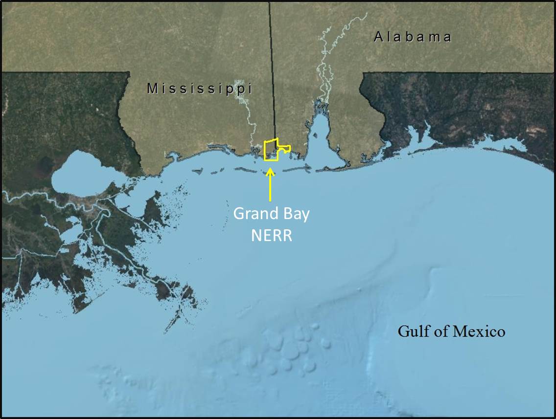
One bay system in Mississippi, Grand Bay National Estuarine Research Reserve (GBNERR), which is located in the southwest corner of Mississippi Sound, has been analyzed using both the SLAMM and ADCIRC models, and conservation indicators developed.
Click to enlarge.
Study Area:
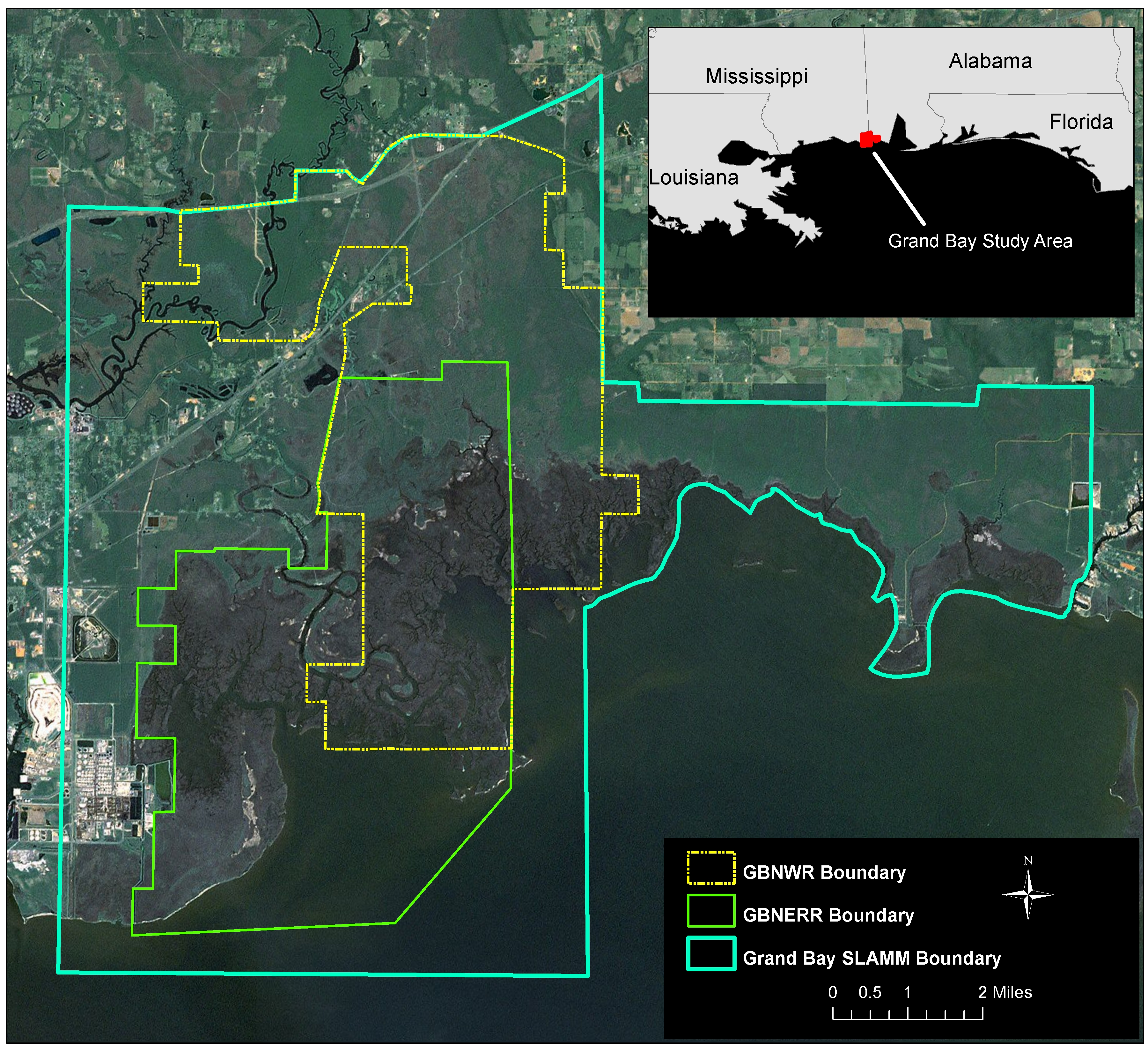
Grand Bay region study area in Mississippi and Alabama.
Grand Bay NERR
The GBNERR encompasses 18,400 acres and is situated in extreme southeast Jackson County in Mississippi adjacent to the Alabama border. It was established in 1999 and it is managed through a unique local, state and federal partnership designed to promote estuarine research and education within Mississippi’s Coastal Zone and its adjacent ecosystems. It is funded by the Mississippi Department of Marine Resources in part through a grant provided by the National Oceanic and Atmospheric Administration.
GBNERR is found chiefly within the Grand Bay National Wildlife Refuge (GBNWR) and the Grand Bay Savanna Coastal Preserve. GBENRR contains a variety of wetland habitats, both tidal and non-tidal, such as pine savannas, salt marshes, saltpans, bays and bayous as well as terrestrial habitats that are unique to the coastal zone such as maritime forests. The NERR contain considerable amounts of estuarine salt marshes and fire-maintained pine savannas, some of the most biological diverse habitats in North America. These habitats support many important species of fish and wildlife. Commercially and recreationally important species of finfish and shellfish such as brown shrimp, speckled trout and oysters abound here. Sea turtles, bottlenose dolphin and, on occasion, manatees can be found in the deeper waters of the reserve. Many species of carnivorous plants and orchids can be found in the higher savanna habitats.
Analyses:
SLAMM
The following images show scenario maps derived from the Sea Level Rise Affecting Marsh Model (SLAMM 6.0). These images show some of the results from the 1 meter of SLR by 2100 scenario which were produced for the Nature Conservancy by Warren Pinnacle Consulting, Inc. The purpose of this series of maps was to show how marshes are predicted to migrate inland due to increases in sea level by 2100. The SLAMM model produced future landcover maps for five time slices for this specific sea level rise scenario, which included actual landcover maps from 2009 and predicted landcover maps for 2025, 2050, 2075 and 2100.
Storm Surge (ADCIRC)
The following maps show the maximum predicted storm surge height for the project sites modeled using Hurricance conditions assuming a 1m rise in sea-level rise by 2100 and were produced for the Nature Conservancy by Arcadis US, Inc. These storm surge maps accounted for future changes in sea level rise by adjusting for local rates of subsidence, a SLR rate based on the 1m rise by 2100 scenario, and future landcover conditions derived from maps produced by the SLAMM model. The maps represent the height in feet of the maximum predicted storm surge from mean seal level (0ft) from the North American Vertical Datum of 1988 (NAVD88) for all land and water areas that experienced a surge in the model.
The three storm surge maps represent the predicted storm surge over the initial condition (2004 or 2009) and predicted storm surge maps for 2050 and 2100. The black line represents the path of the hurricane as it made landfall in the study area.
Conservation and Resilience Analysis
These spatial analyses used the SLR and storm surge scenarios to assess the ecological and socioeconomic components at risk of such climate hazards in each of the project sites, as well as what could be considered future conservation priorities to build a resilient coastal zone. Assessments of the impacts of SLR include the habitats (mostly coastal marshes) that are at risk of inundation for each scenario, and marshes within existing priority areas (protected/managed) that are at risk of inundation. The analysis also assesses the social vulnerability of coastal communities to different SLR scenarios and identifies areas that need to be maintained to allow for flexibility and resilience to take effect. These analyses relate marsh advancement zones to already place-based priorities on land.